Results
4 of 4 results showing for the search for India-China LAC Dispute
China again renames Arunachal Pradesh sites, evokes sharp reaction from India, United States
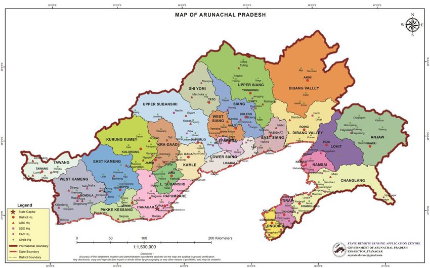
India’s official map of Arunachal Pradesh. ((Map courtesy: State Remote Sensing Application Centre, Government of Arunachal Pradesh)New Delhi: In a move seen as an attempt to escalate the border tensions between China and India, Beijing recentl...
China�s assertiveness raises concerns, German minister Tobias Lindner says
Tobias Lindner (L) speaking at the Raisina Dialogues. (Photo: X/@tobiaslindner)New Delhi: Germany’s minister of state for federal foreign office, Tobias Lindner, has expressed growing concerns over China’s assertive behaviour on the globa...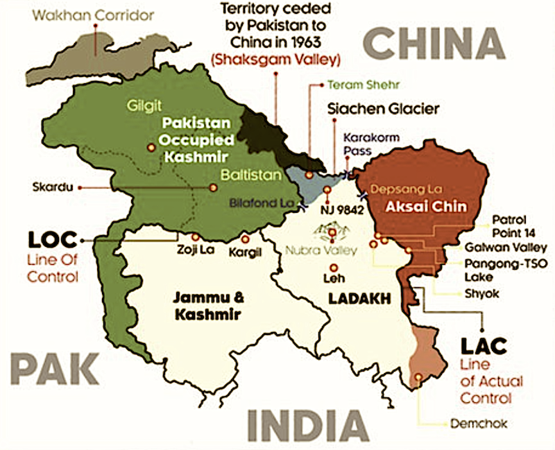
Just 70 kilometres from LAC, China in underground infrastructure-building frenzy in Aksai Chin, reports say
Map of Jammu & Kashmir and Ladakh. Aksai Chin is shown in red, Pakistan-occupied Kashmir in green. (Map not to scale.)New Delhi: China is building tunnels and bunkers just 70 kilometres from the line of actual control in Aksai Chin, at least two ...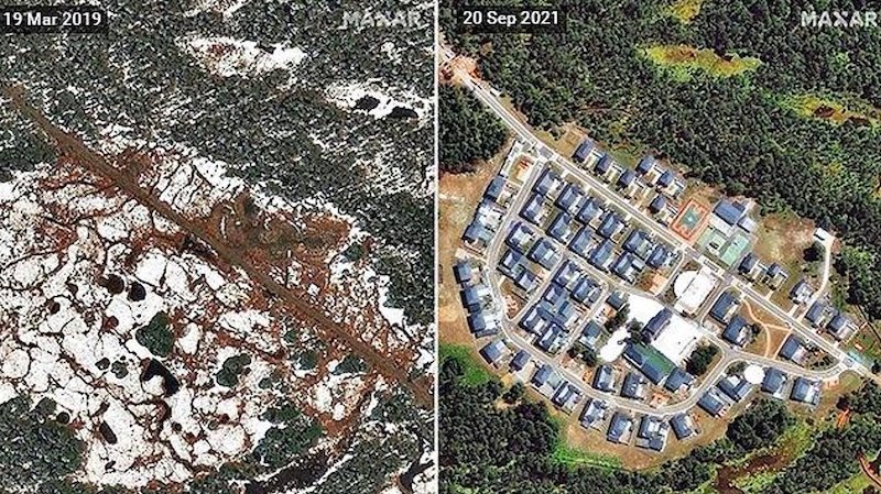
China building villages near LAC even in sensitive areas with focus on India�s east
This two-photo combination shows an under-construction Chinese village, in 2019, and the fully built village, in 2021, inside Indian territory in Arunachal Pradesh. (Photo: Maxar/Twitter)New Delhi: China is rapidly raising border settlements all alon...Results
4 of 4 results showing for the search for India-China LAC Dispute
About Us | Contact Us | Privacy | Cookies